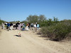
Nathan Harrington led my afternoon WalkingTown DC tour, a scamper through the neighborhoods of Congress Heights. Nathan didn’t have a wealth of heritage markers or quirky landmarks to pause for, and we covered a lot of ground, but the tour was quite enjoyable.
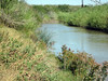
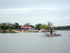
Colonial period settlers used this land as tobacco plantations, but became victims of their success: runoff from the farms silted up the Anacostia River, rendering it no longer suitable for shipping. (Early Bladensburg, upstream, served ocean-going boats until the river filled in.) Later, freedmen like Tobias Henson owned property.
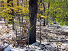
In the late nineteenth century, the heights were put to use as cemeteries for the Jewish community; walking east along Alabama Avenue S.E. from the Congress Heights Metro station, we passed these places of rest. We also passed Malcolm X Elementary School, which provides a STEM curriculum.
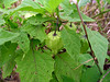
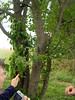
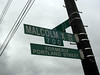 Doubling back and making our way to the small commercial district at the intersection of Martin Luther King Jr. and Malcolm X Avenues S.E., I noticed numerous street trees that resembled Willow Oak (Quercus phellos), but these trees sported very bristly caps to their acorns. A cultivar? A mimic thrush also made its presence known. Nathan’s not sure why this particular intersection warrants the “formerly” signage: the street has been named for Malcolm X for at least fifteen years.
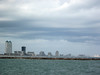
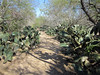
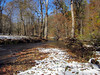
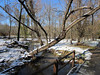
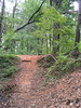
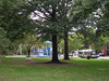 Unfortunately, dining options in Congress Heights are limited. Nathan mentioned the IHOP (franchised to a group of D.C. policemen) to the east, one of the few sit-down restaurants in Ward 8. But the neighborhoods are leafy, and this bit of green extending from Shepherd Parkway is attractive. (Not too many neighborhood folks out today, on this unseasonably cool and wet Sunday.)
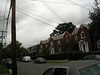
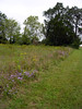
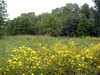
 In the late nineteenth century, Arthur Randle converted about 48 acres of the Knox farm for residential property. The name “Congress Heights” was chosen through a promotional contest, and is typical realtor hyperbole: you can’t actually see the Capitol dome from any ground-level Congress Heights location. Most of today’s residences were built later, in the early to mid-twentieth century. Nathan’s home on 11th Place S.E. (where he treated us to post-tour coffee and superlative banana bread) is a Craftsman bungalow from 1925. Many of the houses of these working- and middle-class neighborhoods are quite spruced up, although security dogs and alarm systems are all too necessary. Certain of the blocks remind me of Archie Bunker’s Hauser Street in Queens. The area holds attractions for would-be homeowners in the District: prices are much lower than west of the Anacostia, and parking is easy-peasy.
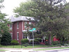
 Local landmark Congress Heights School is back in the education business, now as a charter school.
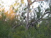
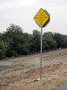
 True to the neighborhood’s mid-century history, fallout shelter signs can still be found. I spotted two for my collection: one at 5th and Mellon Streets S.E., and this one at Brothers and Highview Places S.E.
Further reading: The Advoc8te’s Congress Heights on the Rise; John R. Wennersten, Anacostia: The Death and Life of an American River (2008).
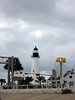
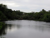
 The point is composed of sandstone, a building material so easily quarried by previous-century settlers that, so the local lore goes, it’s as if someone had posted a sign that read “free stone.”
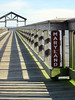 The commonwealth-state boundary runs close to the Virginia shore here, so the fishing pier just downriver is technically in Maryland. The river breeze out of the south was quite fresh, so I did not linger long on the pier.